ProjectsComputer Vision
Flood Area Segmentation System
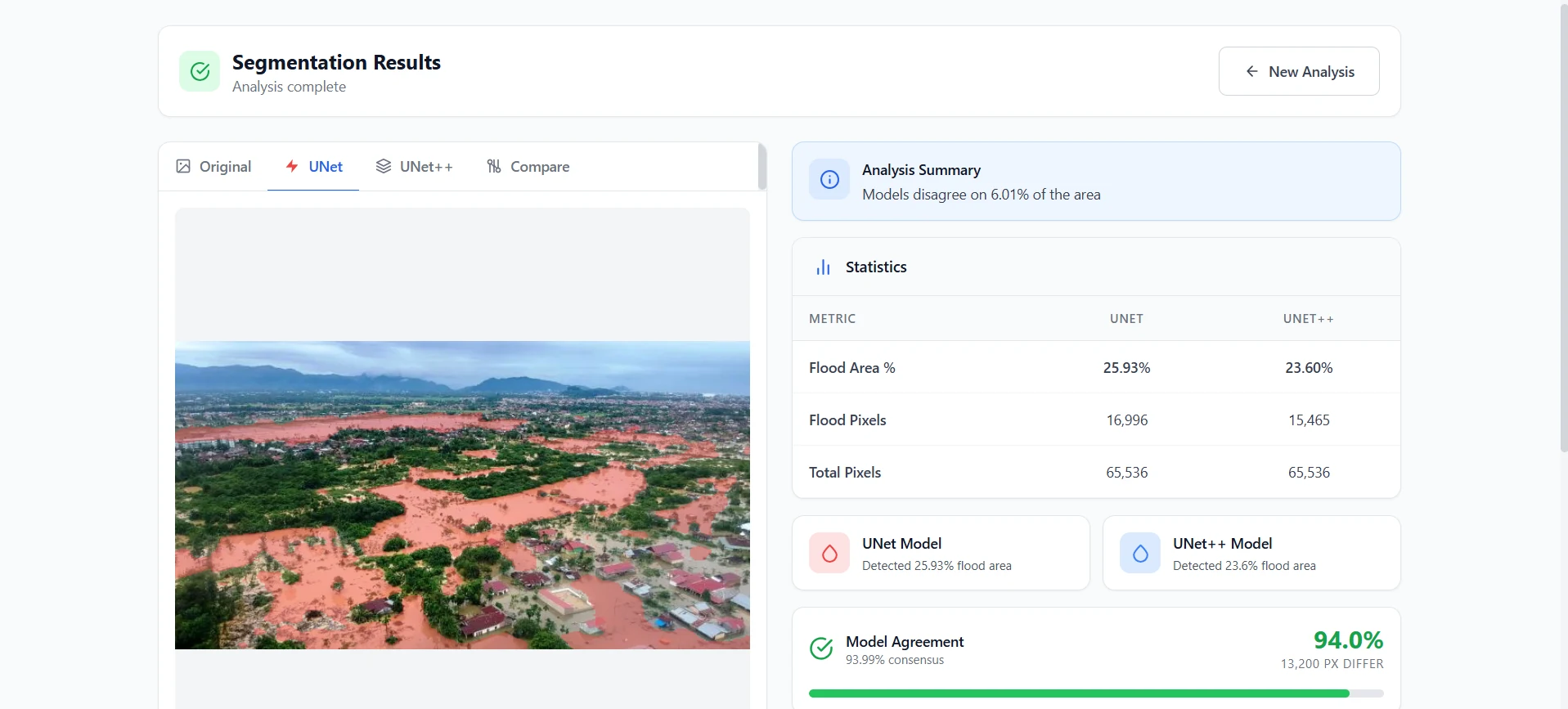
A flood mapping system that detects affected areas from imagery, compares analysis results, and turns visual inputs into faster, more scalable disaster assessment support.
My Role
- 01Trained the flood segmentation models and prepared the inference workflow.
- 02Built the backend pipeline for image upload, mask generation, and comparison output.
- 03Deployed the inference system on Microsoft Azure for online access.
Features
- 01Automatic flood segmentation from uploaded images to generate clear flood masks.
- 02Two models in one system: U-Net and U-Net++ for side-by-side comparison.
- 03Analysis statistics: flood area, flood pixel count, total pixels, and model difference summary.
- 04Compare mode showing original image, model masks, and disagreement map.
- 05Model agreement score to measure prediction consistency.
- 06Python backend inference pipeline deployed to Microsoft Azure.
Impact
- Enables rapid identification of flood-affected areas from imagery.
- Provides quantitative estimates that support reporting and monitoring.
- Facilitates segmentation model evaluation through direct model comparison.
Stack
PythonFastAPIPyTorchU-NetU-Net++OpenCVMicrosoft Azure